Google’s Street View hits the UK
Privacy concerns likely to again be an issue as Google's detailed photo mapping service launches in the UK.

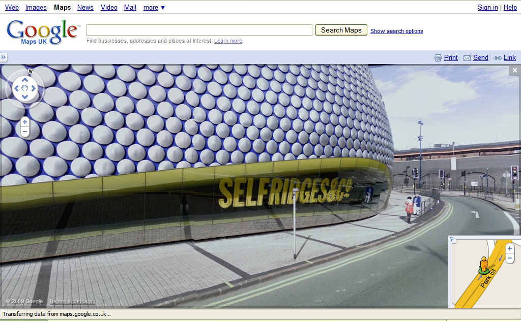
Selfridges in Birmingham via Street View
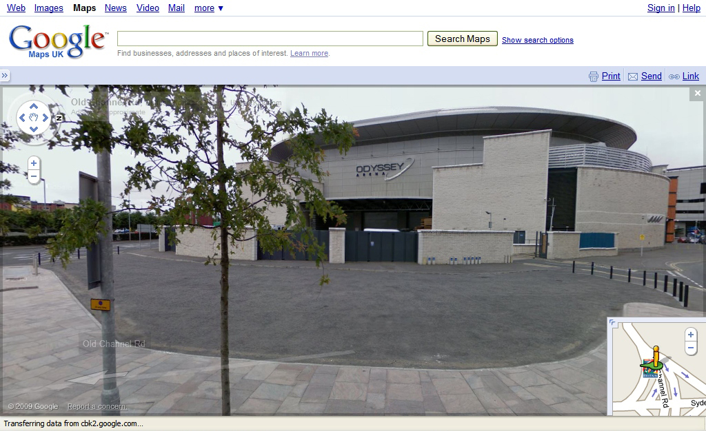
Odyssey Arena in Belfast via Street View
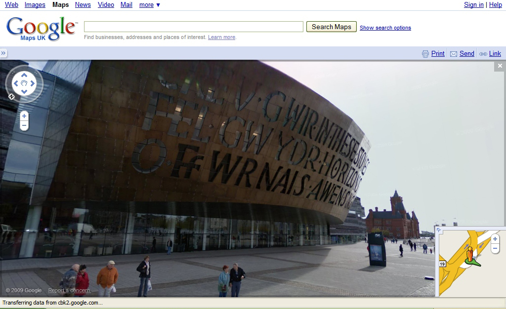
Wales Millennium Centre via Street View
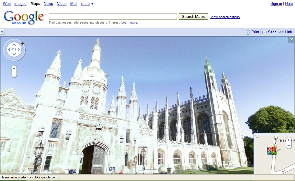
Kings Parade in Cambridge via Street View
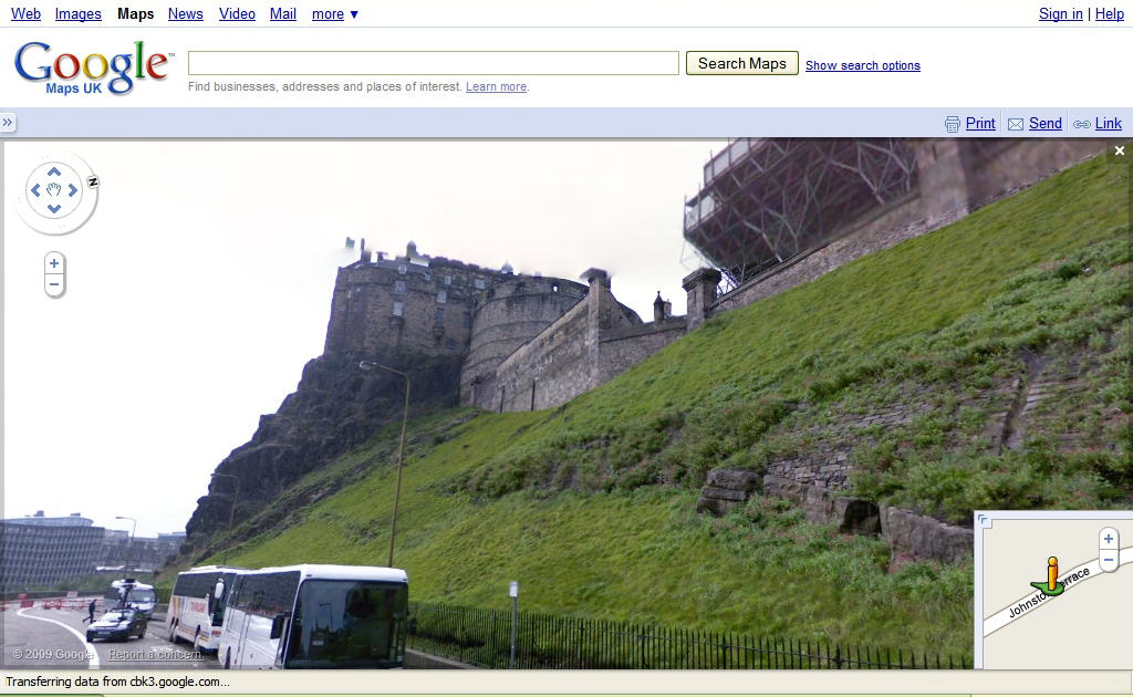
Edinburgh Castle via Street View
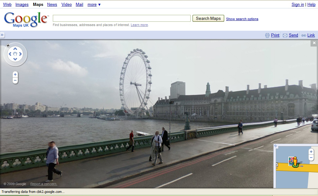
London Eye from Waterloo Bridge via Street View
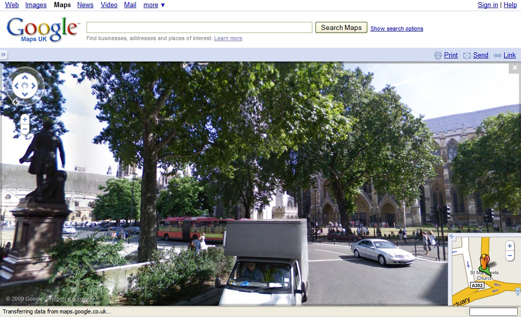
Parliament Square in London via Street View
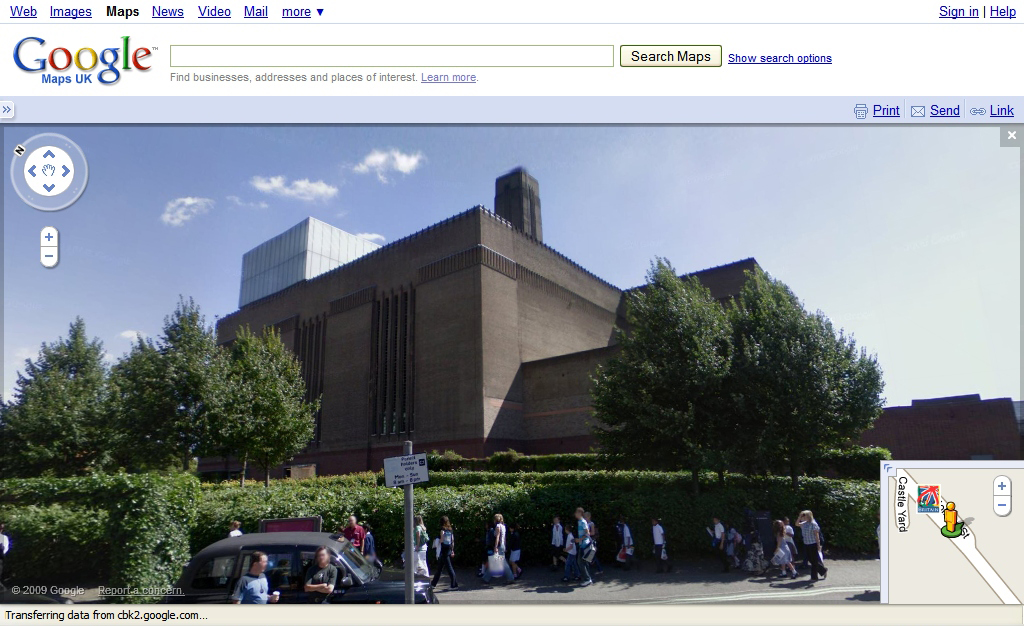
Tate Modern via Street View
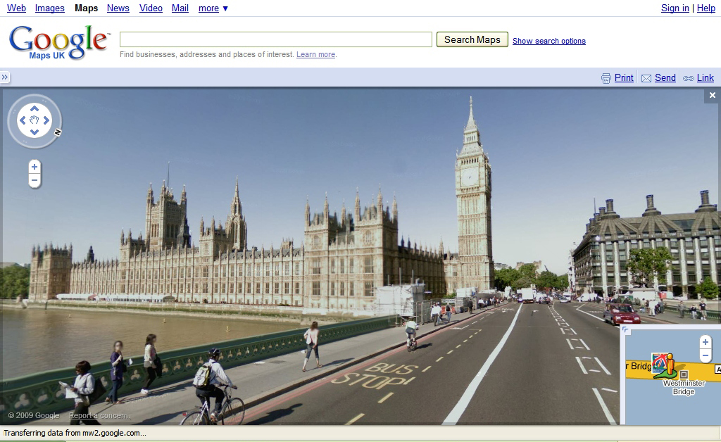
Big Ben via Street View
Google Street View in London
Productivity will take a hit this morning in offices across 25 cities in the UK, as Google's Street View is officially launched, letting us all look up photos of our favourite places and walk down our local streets using our computers.
Street View combines detailed photos with Google's mapping service, letting users view street level, 360-degree images of selected streets. Each view is an average of 12 panoramic photos.
London, Edinburgh and 23 other cities have been included see below for the full list. The IT PRO office hasn't yet been included, but our local pub has made it in.
Click here for Street View photos from around the UK.
Because of the level and detail of coverage, there have been privacy concerns. Japan has banned the Street View and the UK's Liberal Democrats has raised questions in Parliament about it, in addition to other Google services, such as its Latitude mobile phone tracking.
Regarding privacy, Google said in a statement: "Google has gone to great lengths to safeguard privacy while allowing all British users to benefit from this feature. Street View only contains imagery that is already visible from public roads and features technology that blurs both faces and licence plates."
Google said is promising to remove images if requested by individuals, a move which has apparently won approval from the Information Commissioner's Office. Images can be flagged for removal using the "report a concern" link in the system.
Sign up today and you will receive a free copy of our Future Focus 2025 report - the leading guidance on AI, cybersecurity and other IT challenges as per 700+ senior executives
Street View is available via Google Maps, as well as through Google Earth and via Google Maps for Mobile. To access it using Google Maps, zoom as far as you can to street level on a map of a featured city. Grab the little orange "Pegman" icon and hover it over the map; included streets will turn blue. Drop the man icon onto the street you want to see, and the map will flip to Street View.
Google is also pushing the service as a tool for businesses, too, saying they can embed it into their own site for no charge, giving potential customers a view of the company. An example of this using pubs can be seen here.
Google gets the images by driving a van up and down streets, taking photos as it goes. Google said its drivers found London the most difficult place to drive, because of its one-way streets, high buildings and lack of parking. Last summer's rainy weather didn't help, as clear days are needed for driving. As of today, Google's Street View drivers have covered 22,369 miles of UK roads.
Street View is now available in: London, Edinburgh, Leeds, Bradford, Cambridge, Cardiff, Belfast, Birmingham, Manchester, Liverpool, Oxford, Sheffield, Nottingham, Derby, Bristol, Coventry, Glasgow, Aberdeen, Swansea, York, Newcastle, Dundee, Southampton, Norwich, and Scunthorpe.
Freelance journalist Nicole Kobie first started writing for ITPro in 2007, with bylines in New Scientist, Wired, PC Pro and many more.
Nicole the author of a book about the history of technology, The Long History of the Future.
-
 Most data centers are built in unsuitable climates – and it’s seriously impacting efficiency
News Research shows that many data centers are in environments that are too hot, potentially risking safety
-
 Amazon says Russian-backed threat groups were responsible for multi-year attacks on edge devices
News Russian-backed hacker groups are exploiting misconfigured edge devices – now preferring that tactic over hunting down traditional vulnerabilities to gain access to company networks.
